Writing

A numbered series on Africa's public institutions — what's broken, what works, and what the evidence says. Each paper carries a stable WP number and is citable from the Flux registry.

Showing 15 of 35

2026

WP33
What Dies on Election Night
Abstract

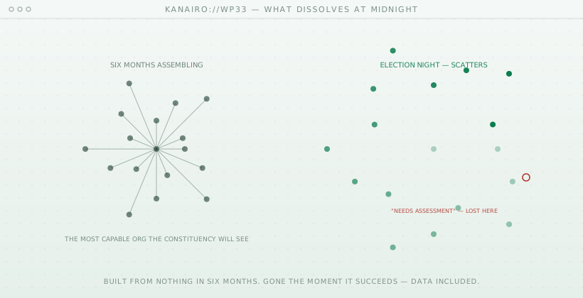
This paper argues that the periodic dissolution of electoral campaign organisations constitutes the principal source of institutional amnesia in Kenyan constituency governance. It observes that a competitive campaign for a parliamentary seat assembles, within approximately two quarters and typically from no prior institutional base, an operational capability exceeding that of the constituency office which succeeds it: sub-location-level field coverage, volunteer rosters numbering in the hundreds, daily logistics and finance functions, and a continuous stream of first-hand testimony regarding constituent needs. It contends that this last asset — effectively the largest informal needs assessment conducted in the country, however methodologically limited by self-selection and interviewer interest — is systematically discarded at the conclusion of each electoral cycle. The paper identifies three structural causes, none attributable to negligence: the legal and organisational separation of campaign vehicles from constituency offices, the seasonal dispersal of campaign personnel, and the absence of any structured format or receiving system into which unstructured campaign knowledge might be migrated. It further observes an inversion in what survives: benign and valuable needs data evaporates while sensitive contact data persists in undocumented form, a pattern the paper attributes to the absence of a designed continuity layer under the Data Protection Act, 2019. The paper concludes that the relevant intervention is continuity infrastructure rather than campaign effectiveness tooling, and proposes as a falsifiable test whether any Kenyan constituency office can commence a term holding a structured, sourced record of constituent requests from the preceding campaign.

25 Jul
8 min
paper ↗
WP32
Legible, Navigable, Writable: What Measuring a City Actually Costs
Abstract

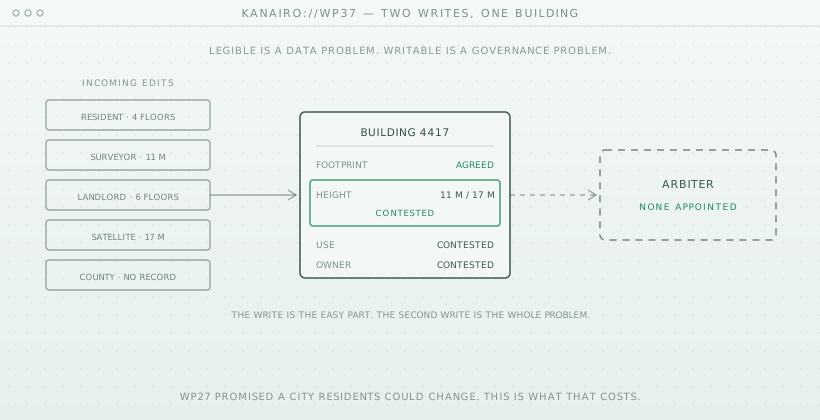
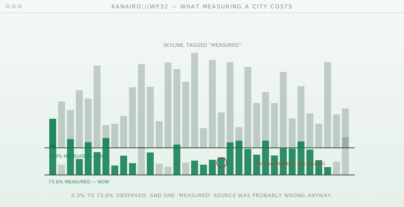
This paper reports the first quantitative result from the Nairobi digital twin programme: the replacement of heuristic building heights with heights measured from satellite imagery across the full metropolitan area. Using Google's Open Buildings 2.5D Temporal dataset, sampled inside each building's real footprint polygon, the proportion of buildings whose height derives from observation rather than inference rose from 0.3% (4,231 surveyed buildings) to 73.6% (1,019,096 of 1,384,206). The paper documents the pipeline — reading only decimated windows from 9.65 GB of Cloud-Optimized GeoTIFFs to produce a 16 MB working raster — and the empirical selection of the median-within-footprint estimator over alternatives. It then reports an unexpected result: validated against Overture Maps' own surveyed height attribute, the imagery heights show a 6.84 m mean absolute error, whereas independent peer-reviewed validation against ICESat-2 laser altimetry places the same dataset at 2.49 m for Nairobi. Having eliminated resampling artefacts as a cause, the paper argues that the discrepancy is attributable primarily to error in the surveyed attribute rather than the imagery, and that a dataset widely treated as authoritative is likely the weaker of the two sources. The paper draws a general conclusion for institutional data infrastructure: systems that store values without provenance cannot adjudicate between conflicting sources, and provenance is therefore a precondition for institutional reasoning rather than a documentation concern. It closes by locating the remaining work — the transition from a navigable model to a writable one — as an institutional rather than a technical problem.

25 Jul
10 min
paper ↗
WP31
Building Nairobi a Second Time: Notes From a Week of Shipping the Twin
Abstract

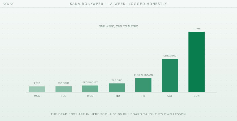
This is the informal companion to Working Papers on the v2 Nairobi buildings pipeline: a first-person process account of the week KaNairo went from roughly 1,000 central-business-district buildings to 1,277,511 across the full metropolitan area. It records the sequence as it actually happened — a Content-Security-Policy block that blanked the first map, duplicate SSL-certificate failures across two fetch scripts, an Overpass API rejection resolved by identifying ourselves properly, and the one genuinely easy step: the data itself, which Overture Maps served in minutes, free. It also records the finding that reframed the work (volunteer map coverage tracks prior attention, not the city — checked directly for Kibera and Mathare), and closes with three transferable lessons for builders attempting the same for other African cities: start from a small real product rather than a platform pitch; use merged data or inherit the attention bias of a single source; and label uncertainty visibly, because that is what buys the right to ship before knowing everything. Technical claims are documented in the three companion papers; this essay is the how-it-felt record the papers deliberately leave out.

13 Jul
7 min
paper ↗
WP30
Estimating What We Don't Know: A Confidence-Tiered Height Heuristic for Data-Sparse Cities
Abstract

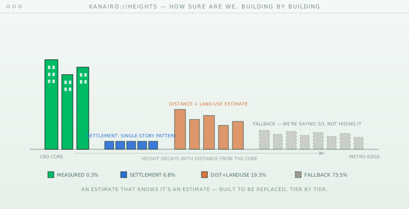
Building height is one of the most consequential and least available attributes in open urban geographic data for African cities. Querying Overture Maps' merged buildings layer for the Nairobi metropolitan area, we find that only 4,203 of 1,277,511 buildings (0.3%) carry a direct height or floor-count attribute from any contributing source. A validated remote-sensing alternative exists — Google's Open Buildings Temporal dataset, shown in peer-reviewed research to estimate Nairobi building heights to 2.5 meters mean absolute error — but requires Google Earth Engine infrastructure not yet provisioned for this project. Rather than leave height unset pending that integration, we built a deliberately provisional four-tier heuristic: direct measurement where available; a single-story estimate for buildings within known informal-settlement boundaries, grounded in established observations about Nairobi's informal housing stock; a distance-decay-from-city-core estimate modulated by Overture's land-use classification, on the standard urban-geography premise that building height correlates with distance from a commercial core; and a flat fallback for buildings matching none of the above. Applied to the full dataset, the tiers split 0.3% measured, 6.8% high-confidence, 19.3% medium-confidence, and 73.5% low-confidence fallback. We argue that labeling an estimate's confidence and publishing the unflattering distribution is preferable to a single undifferentiated height value that looks equally authoritative regardless of its actual basis, and describe the heuristic as designed for incremental replacement, tile by tile, as real height data becomes available.

13 Jul
7 min
paper ↗
WP29
Who's Missing From the Map: Building-Footprint Coverage Gaps in Nairobi's Informal Settlements
Abstract

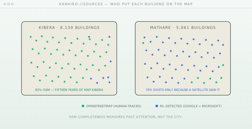
Prior research has established that OpenStreetMap building-footprint completeness varies sharply across Nairobi, with one study specifically noting that Mathare — one of the city's largest informal settlements — had no building footprints in OpenStreetMap at all as of its writing. This paper reports a direct empirical check of that claim against current data, and extends it to a second informal settlement, Kibera, chosen because it is the subject of a long-running, well-known volunteer mapping effort (Map Kibera, active since 2009). We queried Overture Maps' merged building layer — itself a combination of OpenStreetMap, Google Open Buildings, and Microsoft's ML Building Footprints — for both settlements and decomposed each building's source. In Kibera, OpenStreetMap now supplies 82% of mapped buildings (6,706 of 8,130); in Mathare, it supplies 16% (794 of 5,061), with Google's Open Buildings alone supplying 70%. We argue the difference is not explained by population, informality, or physical mapping difficulty — both settlements share all three — but by the presence or absence of a dedicated volunteer mapping campaign, meaning OpenStreetMap completeness in under-resourced urban areas is closer to a measure of prior philanthropic/NGO attention than a measure of the area itself. We conclude that any civic-technology project sourcing building data for African urban contexts should default to a merged, ML-supplemented dataset rather than OpenStreetMap alone, precisely because doing otherwise systematically undercounts the places least likely to have institutional attention in the first place.

13 Jul
6 min
paper ↗
WP28
From the CBD to All of Nairobi: A Tile-Streamed Building Pipeline for a City-Scale Twin
Abstract

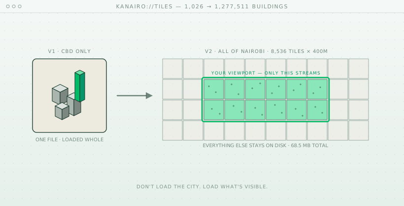
The first render of Flux's Nairobi digital twin covered roughly 1,000 buildings in the central business district, sourced from OpenStreetMap via the Overpass API and compressed into a single static bundle. This paper documents extending that render to the full Nairobi metropolitan area — approximately 1,600 square kilometers from Karen to Embakasi and Ruiru to Athi River — using Overture Maps, an open dataset that merges Google's Open Buildings (satellite-imagery-derived footprints), Microsoft's ML Building Footprints, and OpenStreetMap into a single deduplicated layer. The resulting extract contains 1,277,511 building footprints and 3,782 land-use features, roughly 1,250 times the building count of the original CBD-only extract. We describe why this scale cannot be loaded into a browser as a single static file the way the CBD extract was, and the tiling architecture built to stream it instead: a 400-meter grid stored as a flat SQLite file (8,536 tiles, 68.5MB), served through a Django endpoint and requested by the client only for the portion of the city currently in view. We report the pipeline's real performance characteristics, its deliberate exclusion from the production database used by other Flux services, and the specific respects in which it remains an unfinished foundation rather than a finished product — principally, that building heights are estimated rather than measured for all but a small fraction of the dataset, addressed separately in a companion paper.

13 Jul
8 min
paper ↗
WP27
The Twin Nairobi Doesn't Have Yet
Abstract

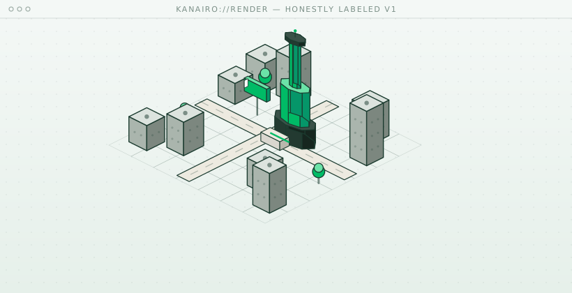
"Digital twin" typically describes a 3D visualization exercise, yet the term originates from live-telemetry systems built to track one physical object's real condition, not from rendering fidelity. This paper argues a genuine 1:1 city twin needs two separate, so-far-unconnected halves. The first, institutional, is a live data-exchange layer between government systems, on the model of Estonia's X-Road — architected as a decentralized system after a 1996 data-consolidation scandal and now connecting over 450 institutions and 3,000 services under a "once-only" principle — with Nairobi's 2014 Digital Matatus project, which mapped over 130 informal transit routes into open transit data now used in Google Maps, presented as an existing partial precedent. The second, participatory, is a citizen-facing write interface, descended from a lineage running through Jay Forrester's 1969 Urban Dynamics and Will Wright's SimCity, and paralleled by Kenya's own Ushahidi (2008) and Nairobi's own MajiVoice utility-complaint system, UN-Habitat's Minecraft-based Block by Block co-design program, and academic digital-twin/participation projects in Helsinki and Rotterdam that researchers describe as "limited by design." No verified project has combined both halves persistently at full city scale, wired to real institutional dispatch. Using KaNairo — Flux's explorable 3D model of Nairobi, with a real, paid joke billboard as its first citizen-facing interaction — as a live case, the paper argues that closing both gaps, sector by sector, is the actual roadmap, and that the render and the billboard are the honestly-labeled first steps of a much longer build, not the finish line.

8 Jul
22 min
paper ↗
WP22
Your NGO Is Illegal and That Is Not Your Fault
Abstract

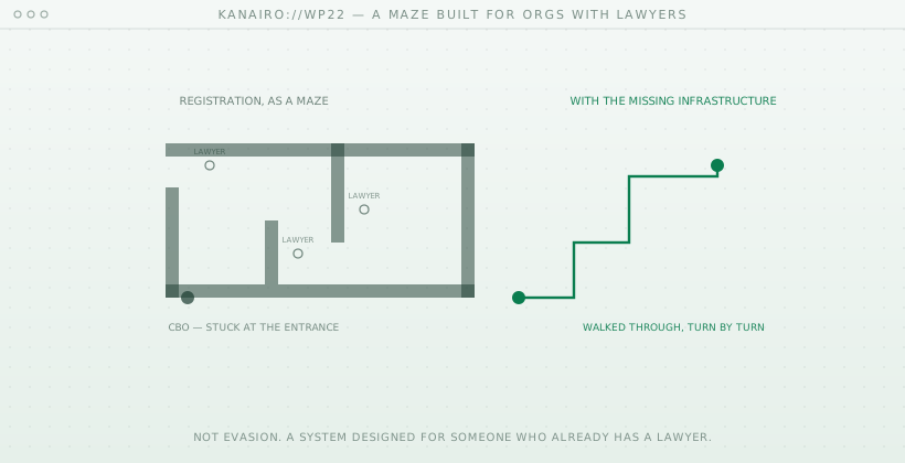
Kenya's civil-society compliance gap is often read as organisations evading registration. This paper argues it is better understood as the product of a registration system designed for organisations with lawyers, and examines what changes once the infrastructure to navigate that system finally exists.

10 Jun
10 min
paper ↗
WP16
Africa's Regulatory Failure Is Not a Law Problem
Abstract

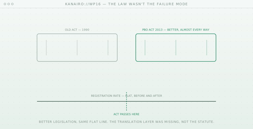
Kenya's PBO Act improved on its predecessor in nearly every respect, yet registration rates did not meaningfully rise. This paper argues that the recurring failure mode in African regulatory reform is rarely the quality of the law itself but the absence of a translation layer that makes the law navigable to those it governs.

24 May
8 min
paper ↗
WP15
Your Donor Is Now Your Regulator
Abstract

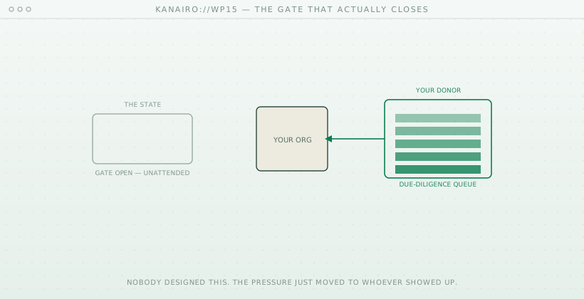
International donors' due-diligence requirements increasingly impose compliance pressure that the Kenyan state itself has never consistently applied. This paper argues that the organisations least able to meet these requirements are often those doing the most essential ground-level work, producing an unintended regulatory effect that nobody designed. Understanding the mechanism, it argues, is the first step to addressing it.

20 May
8 min
paper ↗
WP14
What a Language Model Finds When It Reads Your Constitution
Abstract

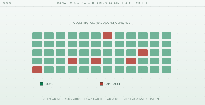
Discussion of AI and law fixates on whether AI can reason about law. This paper argues that a more tractable problem is already solved: reading a document against a specific checklist to identify gaps. Using the example of constitutive documents checked against statutory requirements, it shows what reliable document-versus-checklist analysis can do today and why it matters for compliance.

16 May
8 min
paper ↗
WP13
Kenya's PBO Act Is Finally in Force After a Decade. Most Organisations Still Cannot Comply.
Abstract

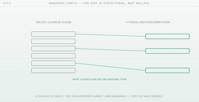
Kenya's Public Benefit Organizations Act came into force after more than a decade of delay, yet most organisations still cannot comply. This paper argues the Act's requirements are not unreasonable but inaccessible, walking through what compliance actually demands and showing that the gap between what the law requires and what a typical community-based organisation has is structural rather than a matter of intent.

12 May
10 min
paper ↗
WP08
Procuring the Unspecifiable: Why Institutional Software Procurement Is Broken in Kenya
Abstract

Kenya's Public Procurement and Asset Disposal Act treats software as a commodity that can be fully specified in advance, compared by price, and delivered on a fixed date. This paper argues that this assumption is mismatched to how software is actually built, producing a predictable cycle of failed systems, vendor capture, and fraud-enabling infrastructure. It argues for reconceiving software as a distinct category of public acquisition with iterative delivery and long-term stewardship.

25 Apr
20 min
paper ↗
WP05
Democracy Is Infrastructure
Abstract

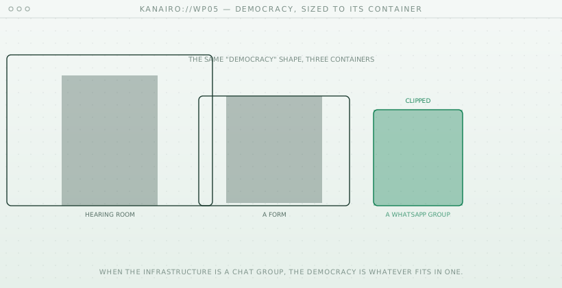
Democracy is usually discussed as a matter of values and ideals. This paper argues that in practice democracy is constituted by the infrastructure it runs on: when the operational substrate of a civic process is an ad-hoc messaging group, the democracy is whatever fits in that container. It makes the case that improving democratic practice in African contexts is substantially a problem of building better civic infrastructure.

14 Mar
8 min
paper ↗
WP03
What Happens When Institutions Can Finally See Themselves
Abstract

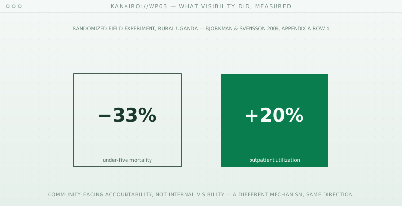
What changes when an institution can finally see itself? This paper explores the consequences of operational visibility: a utility that tracks its own production and losses in real time, a constituency office that knows the status of every case. It argues that visibility is not an end in itself but the precondition for correction, accountability, and trust, and sketches the shifts in management and legitimacy that follow once institutions can observe their own work.

12 Feb
8 min
paper ↗